Thanks to the great work of Grant Slater and the OpenStreetmap team, there are freely available XYZ tilesets for South Africa and Namibia 1:50 000 series toposheets which can easily be added to QGIS. Here is the general procedure to add a layer:
1.) Open the browser panel (View -> Panels -> Browser) and scroll down to the entry called XYZ tiles if needed.
2. ) Right-click the XYZ tiles entry and choose 'New Connection...'
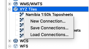
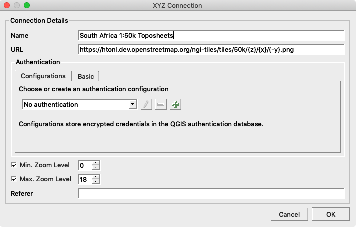
3.) Enter the connection details (see the bottom of this post for the SA and Namibia connection URLS
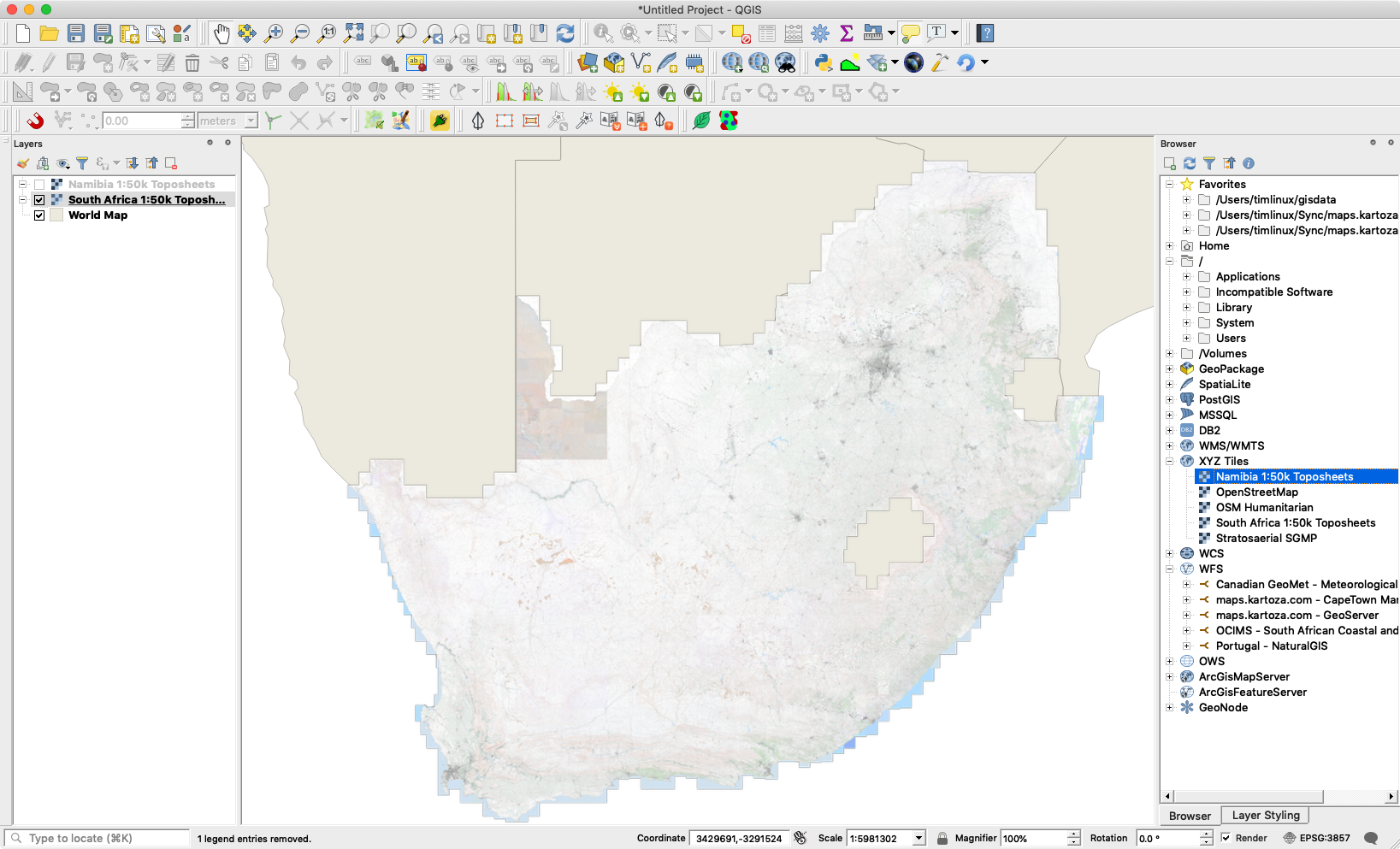
4.) Double click or drag-an-drop the XYZ tile layer into the canvas
5.) You should see a nicely rendered tileset like this:
Useful XYZ tile urls:
- Namibia 1:50 000 toposheets: https://namibia-topo.openstreetmap.org.za/layer/na_sgswa_topo_50k/{z}/{x}/{y}.png
- South Africa 1:50k Toposheets: https://htonl.dev.openstreetmap.org/ngi-tiles/tiles/50k/{z}/{x}/{-y}.png
- South Africa NGI Imagery: http://aerial.openstreetmap.org.za/ngi-aerial/{z}/{x}/{y}.jpg
-
Zanzibar Mapping Initiatives: https://tiles.openaerialmap.org/user/5ac4842b26964b0010033104/{z}/{x}/{y}.png
Comments
Comment awaiting approval 4 years, 6 months ago
New Comment